
Floods are the most common natural disaster on Earth, accounting for over 40% of such events worldwide in 2023.
Floods can cause serious problems, such as damaging homes, destroying crops, and even leading to loss of life.
In 2023, there were 170 flood disasters worldwide, showing how widespread this issue is.
To keep our communities safe, it’s important to plan ahead for floods.
This means understanding the risks, making strong plans, and being ready to act quickly when floods happen.
By doing this, we can reduce the damage floods cause and protect the people we care about.
Risk Management and Floodplain Delineation
Frameworks for Flood Risk Assessment
Frameworks for flood risk assessment typically involve evaluating hazards, vulnerabilities, exposures, and capacities.
These frameworks help in understanding the potential impacts of floods and in planning appropriate mitigation measures.
Techniques for Floodplain Mapping
Floodplain mapping: often utilizes Geographic Information Systems (GIS) to delineate areas prone to flooding.
Techniques: include hydrologic and hydraulic modeling, remote sensing, and the use of high-resolution digital elevation models (DEM’s).
Defining Flood Risks and Threats
Flood risks and threats are defined by considering the probability of flooding events and their potential consequences.
This involves analyzing historical flood data, climate change projections, and the physical characteristics of the area.
Identifying Vulnerable Areas and Populations
Identifying vulnerable areas and populations involves mapping socio-economic data, infrastructure, and environmental factors.
This helps in prioritizing areas that need immediate attention and resources for flood risk management.
Tools and Techniques for Flood Risk Assessment
These include hydrological models, hydraulic models, remote sensing, and GIS-based tools.
These tools help in predicting flood behavior, assessing potential impacts, and planning mitigation strategies.
Vulnerability Analysis Flood Management
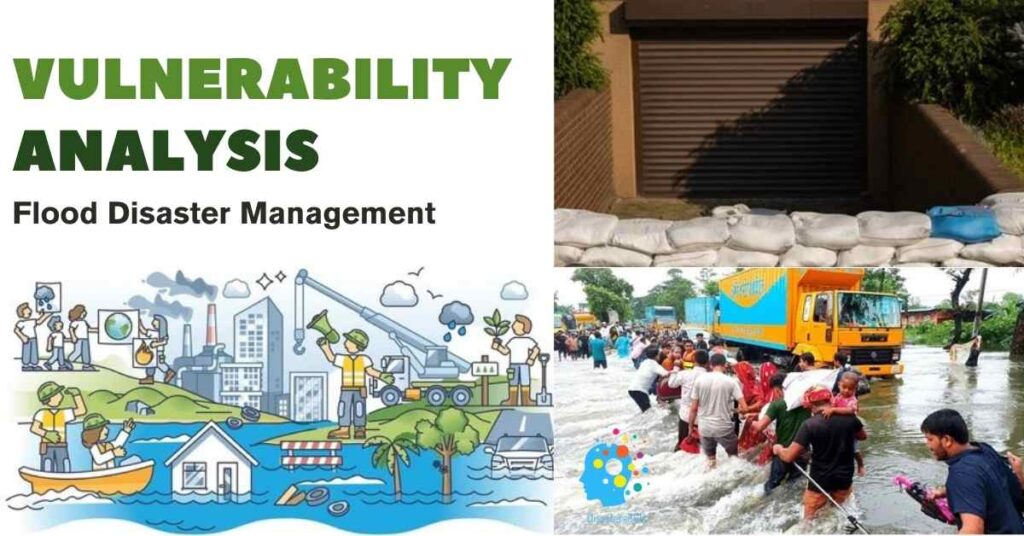
Assessing Impacts on Populations, Infrastructure, and Environment
This involves looking at how floods could affect people, buildings, roads, and nature.
It’s important to know who and what is at risk.
Importance of Public Participation in Defining Acceptable Risks
Engaging the community involved in deciding what level of risk is acceptable.
People need to understand and agree on the safety measures.
Flood Risk Mapping
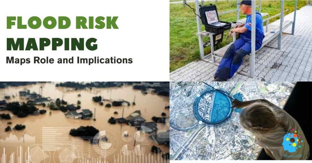
The Role of Maps in Emergency Planning and Response
Maps are important because they help us plan for emergencies and respond quickly when floods happen.
Legal Implications and Public Education through Mapping
Maps also help with legal matters, such as building codes, and educate the public about flood risks and safety.
Flood Emergency Preparedness and Response
Importance of Advance Warning Systems
It’s crucial to have systems that warn people about floods before they happen, so they can stay safe.
Resource Inventory and Training for Response Teams
We need to know what resources we have (such as boats, sandbags, etc.) and make sure response teams are trained and ready to act.
Structural Measures for Flood Mitigation
Construction of Dams, Levees, and Storm Channels
- Dams: These are large structures built across rivers to control the flow of water.
They help store water during heavy rains and release it slowly to prevent floods. - Levees: These are raised banks built along rivers to keep the water from overflowing into nearby areas. They act like barriers to protect land from flooding.
- Storm Channels: are specially designed channels that direct excess rainwater away from populated areas and into safe places, like lakes or oceans.
Flood-Proofing Measures for Critical Infrastructure
- Flood-Proofing Buildings: This involves making important buildings, like hospitals and power plants, more resistant to floods.
This can include raising the building, waterproofing the walls, or installing barriers to keep water out. - Protecting Utilities: Ensuring that essential services like electricity, water supply, and communication systems are safeguarded from flood damage.
Maintenance and Inspection of Flood-Control Structures
- Regular Checks: It’s important to regularly inspect dams, levees, and storm channels to ensure they are in good condition.
- Repairs: Fixing any damage or weak spots in these structures to ensure they work properly during floods.
Non-Structural Measures Flood Management
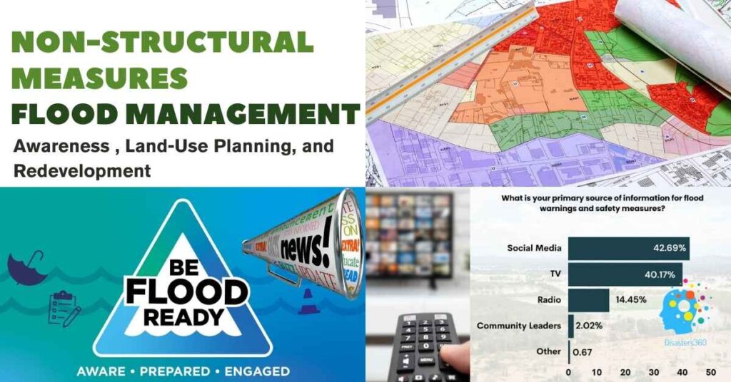
Land-Use Planning and Zoning Regulations
This means deciding how land should be used and establishing rules to keep buildings and homes away from areas that could flood.
By planning where to build things, we can reduce the damage from floods.
Public Awareness Campaigns and Education
This involves teaching people about floods and how to stay safe.
We can use posters, TV ads, social media, and school programs to spread the word.
When people know what to do, they can protect themselves better.
Redevelopment and Relocation Programs for Flood-Prone Areas
This means improving or moving buildings in areas that flood often.
By fixing up old buildings or moving them to safer places, we can keep people and their homes safe from floods.
Supportive Technologies For Flooding
Use of Geographic Information Systems (GIS) for Flood Forecasting
GIS is a special tool that helps us predict where floods might happen.
It uses data like weather reports and past flood patterns to make accurate forecasts.
This helps us prepare for floods before they happen.
Real-Time Mapping for Communication and Emergency Action
Real-time mapping refers to creating maps that display current conditions.
During a flood, these maps can indicate which areas are flooded, helping people know where it is safe to go and which areas to avoid.
This helps emergency teams take quick action to help people.
Visualization Techniques for Community Engagement
Visualization techniques involve creating easy-to-understand pictures and graphs to show flood risks and safety plans.
These visuals help the community understand the dangers and how to stay safe during floods.
When people can see the information clearly, they are more likely to take action.
Policy Development and Implementation
Basin-Wide Planning and Inter-Agency Collaboration
This means making plans for flood management that cover whole river basins, not just small areas.
It also involves different agencies and groups working together.
By looking at the big picture and collaborating, we can handle floods more effectively.
International Cooperation for Transboundary Flood Management
Sometimes, rivers flow through more than one country, so it’s important for these countries to work together to manage floods.
International cooperation helps ensure that all countries involved have a plan and share information to reduce flood risks.
Role of Organizations like UNDP and WMO
UNDP (United Nations Development Programme) and WMO (World Meteorological Organization) are organizations that help countries manage floods.
They provide resources, knowledge, and support for creating flood management plans.
These organizations play a big role in coordinating efforts and helping countries work together.
Climate Variability and Its Impact on Flooding
Effects of Climate Change on Storm Intensity and Flood Patterns
Climate change makes storms stronger and more intense.
This means more rain in a short time, which can lead to flooding.
Also, as the climate changes, the places and times floods happen can change, making it harder to predict and prepare for them.
Preparing for Sea-Level Rise and Extreme Weather Events
- Sea-Level Rise: As the climate warms, ice caps and glaciers melt, causing the sea levels to rise.
This can lead to more flooding in coastal areas, especially during high tides and storms. - Extreme Weather Events: Climate change can cause more extreme weather, like heavy rains and hurricanes.
We need to prepare for these events by improving our flood defenses and having emergency plans in place.
Watershed Management
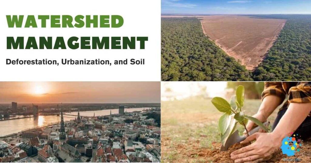
Role of Vegetation and Soil in Natural Water Storage
Vegetation: Plants, trees, and grass help absorb rainwater and slow down its flow.
Their roots hold the soil together, preventing erosion and helping water soak into the ground.
Soil: Healthy soil acts like a sponge, soaking up rainwater and storing it.
This helps reduce runoff and lowers the risk of flooding.
Impacts of Deforestation and Urbanization on Flood Dynamics
Deforestation: Cutting down trees and removing vegetation makes it harder for the soil to absorb water.
This leads to more runoff and increases the risk of flooding.
Urbanization: Building roads, houses, and other structures on natural land covers the soil and prevents water from soaking in.
Instead, water runs off quickly into rivers and streams, which can cause floods.
Major Flood Disasters in the United States (2000–2024)
Here is a list of significant flood disasters in the United States from 2000 to 2024:
| Year | Event Name | Affected Regions | Impact |
|---|---|---|---|
| 2006 | Mid-Atlantic Flood | Maryland and Pennsylvania | Heavy rains led to significant flooding, with rainfall amounts up to 17 inches. |
| 2008 | Midwest Flooding | Iowa, Wisconsin, Indiana, Minnesota, Michigan, Missouri | Extensive flooding affected multiple rivers, causing widespread damage. |
| 2016 | West Virginia Floods | West Virginia | One of the deadliest floods in state history, with 23 fatalities and approximately $1.2 billion in damages. |
| 2016 | Louisiana Floods | Louisiana | Prolonged rainfall resulted in catastrophic flooding, with at least 60 deaths and over $10 billion in damages. |
| 2017 | California Floods | California | The wettest winter in nearly a century led to widespread flooding, causing over $1.05 billion in road and highway damages. |
| 2024 | Hurricane Helene Flooding | North Carolina and Southeastern states | Catastrophic flooding caused over 200 deaths, highlighting the deadly impact of increased inland rainfall. |
This table provides an overview of major flood events in the U.S. over the past two decades, illustrating the widespread impact of flooding across various regions.
Case Studies
Yangtze River, China
Yangtze Digital Twin: China used advanced technology to create a virtual model of the Yangtze River. This model helps predict floods and plan responses. It has improved disaster preparedness and reduced damage from floods.
Yangtze Digital Twin: Transforming Flood Management
Winnipeg, Canada
Red River Floodway: After a major flood in 1950, Winnipeg built a large ditch called the Red River Floodway, also known as Duff’s Ditch. This ditch helps divert floodwater away from the city, protecting homes and businesses. It has saved the city from many floods since then.
Flood Control Infrastructure
Conclusion
- Managing floods effectively means using both structural and non-structural measures.
- Structural measures like building dams and levees help control water, while non-structural measures like land-use planning and public education help reduce risks.
- Long-term planning is crucial because floods can happen at any time.
- By thinking ahead and preparing now, we can protect our communities in the future.
- Public engagement is also important.
- When people understand the risks and what to do, they can help make their communities safer.
References and Supporting Data Flood Disaster Management
Here are some valuable resources on flood disaster management:
- Habitat for Humanity: Floods and Flash Floods – Disaster Preparedness
- Offers practical advice on preparing for floods, including building emergency kits and establishing family communication plans.
- Ready.gov: Floods
- Provides comprehensive guidelines on creating household plans, practicing evacuation routes, and gathering necessary supplies for flood situations.
- FEMA: Flood – Protective Actions
- Highlights safety measures during floods, emphasizing the dangers of floodwaters and the importance of staying informed.
- OSHA: Flood Preparedness and Response
- Discusses hazards associated with floods, including chemical and biological risks, and outlines safety protocols for response and recovery.
- National Flood Insurance Program: Disaster Response
- Details resources available through FEMA’s program to assist communities before, during, and after flooding disasters.
- National Weather Service: Flood Safety and Preparedness
- Offers information on actions to take before, during, and after a flood to ensure safety.
- American Red Cross: Flood Safety and Preparedness
- Provides tips on flood preparedness, including evacuation plans and emergency kits.
- City of Patterson, CA: What To Do Before, During, and After a Flood
- Gives localized advice on flood preparedness and response, applicable to various communities.
- American Academy of Pediatrics: Flash Floods and Flood Recovery
- Focuses on the impact of floods on children and offers resources for disaster management.
- Wikipedia: Floods in the United States (2000–present)
- list of flood events which were of significant impact to the country during the 21st century, since 2000.
Key Elements for Inclusion
Risk assessment identifies hazards and vulnerabilities. Strategies include structural (dams) and non-structural (zoning).
Tech aids like GIS, public involvement, and adaptive policies help mitigate flood impacts. Emergency plans and drills ensure readiness.
Flood Risk Assessment Framework
Hazard identification and vulnerability analysis: This means figuring out what could cause floods and who or what might get hurt. We look at things like weather patterns, terrain, and where people live.
Development of mitigation strategies and policies: Creating plans and rules to reduce the impact of floods. This might include building structures or making laws to keep people safe.
Structural vs. Non-Structural Approaches for Flood
Structural: These are physical things we build to stop or control floods, like dams, levees, and making buildings flood-proof.
Non-structural: These are plans and policies that help reduce flood risks, like deciding where to build homes (land-use zoning) or creating insurance programs to help people recover from floods.
Role of Technology Management in Flood Disaster
GIS for mapping and planning: Geographic Information Systems (GIS) are tools that help us make detailed maps to see which areas are at risk of flooding and plan how to protect them.
Real-time flood forecasting systems: These systems predict floods as they are happening, helping us respond quickly to protect people and property.
Community Involvement Flood Planning
Public education on flood risks: Teaching people about the dangers of floods and how they can stay safe. This can be done through schools, TV, social media, and community meetings.
Participatory planning for risk acceptance: Getting the community involved in planning for floods. This helps people understand the risks and agree on what safety measures to take.
Impact of Climate Change
Increased flood risks due to changing precipitation patterns: Climate change can cause more intense and frequent rain, increasing the risk of floods.
Need for adaptive policies: Creating flexible policies that can change as the climate changes. This helps ensure we are always prepared for new flood risks.
Emergency Response Mechanisms
Resource inventories and evacuation plans: Knowing what resources (like boats and sandbags) are available and having clear plans for getting people to safety during a flood.
Training and periodic drills for responders: Regular training and practice drills for emergency teams, so they are ready to act quickly and effectively when floods happen.
FAQ’s
Section: The Role of Weather Experts in Disaster Preparedness?
Introduce this section by discussing how meteorologists and storm chasers play a crucial role in predicting severe weather and guiding disaster management efforts.
1. What is Risk Management of Flood?
Flood risk management is about the prevention of floods, and for floods that does occur, making sure that damage is minimized.
This requires a number of steps:
1) Identification: Identifying lands and peoples which are susceptible to flooding.
2) Risk Assessment: Study of potential severity and likelihood of flooding events
3) Mitigation: Efforts to lessen the effects of flooding, like constructing levees, or moving buildings.
2. What is Floodplain Delineation?
Mapping/media testing floodplains involves determining areas that are likely to be inundated in case of flooding. This data is essential for: * Flood Management: Identifying areas where special building codes or restrictions are needed. * Development Planning: Steering building and land use decisions away from potentially flooded areas
3. What are the Different Flood Risk Management Practices?
All approaches are used to manage flood risk in different ways:
Structural: (Dams, levees) barrier systems that impede and drain excess water outside.
Non-structural Measures: land use planning, early warning systems and public education to reduce vulnerability
Insurance: Weaning a bite of flood defense and covering the loss, providing financial protection for the people and communities impacted by floods (Flood insurance, Disaster Recovery)
4. What are the Options for Flood Risk Management?
Explanation:
Controlling Water: Physically Engineering Methods – Dams/Levees.
Nature-based Solutions: Deploying wetlands and other natural features to soak up floodwaters.
Implementing Community-based Solutions: Involving local populations in the planning and execution of flood prevention strategies (“Emergency Planning,” “Crisis Management”).
5. What is the Risk Management of Water?
Reason: Water risk management is a wider term that includes all water-related risks.
Floods: Too much water.
Droughts: Water scarcity.
Water Pollution: Water sources are contaminated.
6. What are the Flood Risks?
Explanation: Floods have a downright evil side:
Death toll: From drowning or other flood-related dangers.
Property damage: Homes, businesses, and infrastructure destroyed.
Infrastructural damages: Roads, bridges, power lines, etc.
Environmental degradation: Polluting water sources and soil erosion.
7. What Factors Increase the Risk of Flooding?
Reason: Due to numerous factors, flood risk may increase:
Urbanization: More impervious surfaces (pavement, concrete) which prevent the absorption of water.
Deforestation: Deforestation leaves the land unable to retain water.
Climate Change: More intense precipitation and rising seas.
Insufficient Infrastructure: Drainage systems in precarious conditions and protection measures against flooding lacking.
8. What is an Example of Flood Management?
Building a floodwall: A physical structure that is used to serve a location from being submerged by floodwaters.